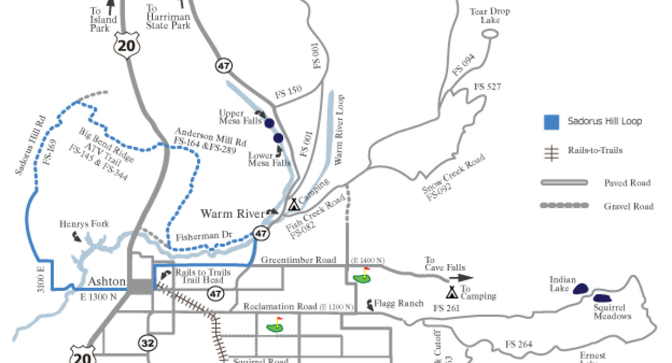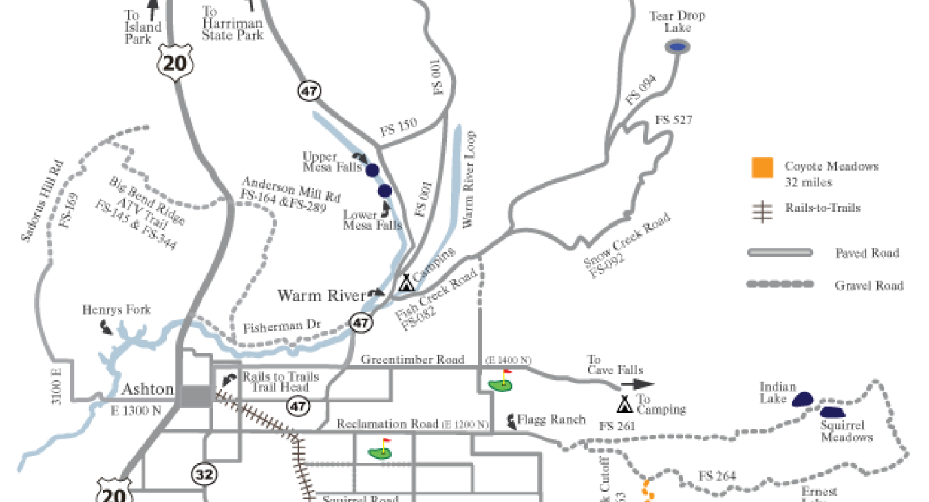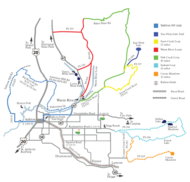
The routes on this map use Targhee Forest Service roads near Ashton, and follow Forest Service signage. Except for Fish Creek/Baker Draw Roads, all roads are gravel/dirt multipurpose roads used by ATVs, campers and pickups. The roads are suitable for mountain bikes, but are not exclusively designed for bicycles. Cyclists must comply with all traffic laws and Forest Service regulations.
The routes may be accessed from Ashton, or more directly from the Warm River campground or the end of the pavement on Reclamation/Flagg Ranch Road 12 miles east of Ashton. Fish Creek and Baker Draw roads east of the Warm River campground are paved, and feature significant climbs.
Sandorus Hill Loop - 25 miles
This loop travels west from Ashton on the Henrys Fork Byway, crosses the Henry’s Fork at Ora Bridge, turns right (north) at the ‘T’, follows the pa
Coyote Meadows Route - 32 miles
This gravel route begins on the Reclamation/Flagg Ranch Road, follows the Conant Creek cutoff (FS-263) south to the Coyote Meadows Road (FS-265), r
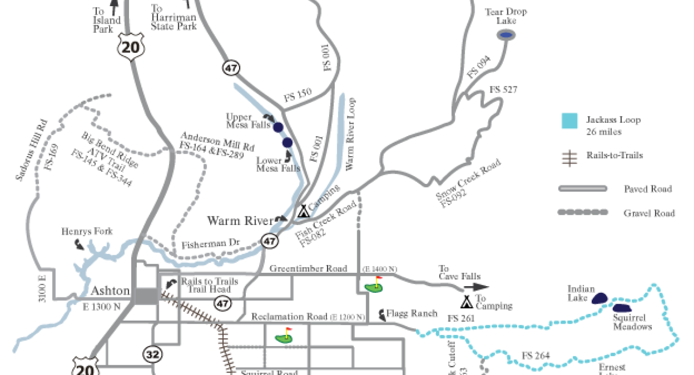
Jackass Loop - 26 miles
This loop follows the Reclamation/Flagg Ranch Road east of Ashton, continues on a gravel road (FS 261) beyond Indian Lake and Squirrel Meadows, tur
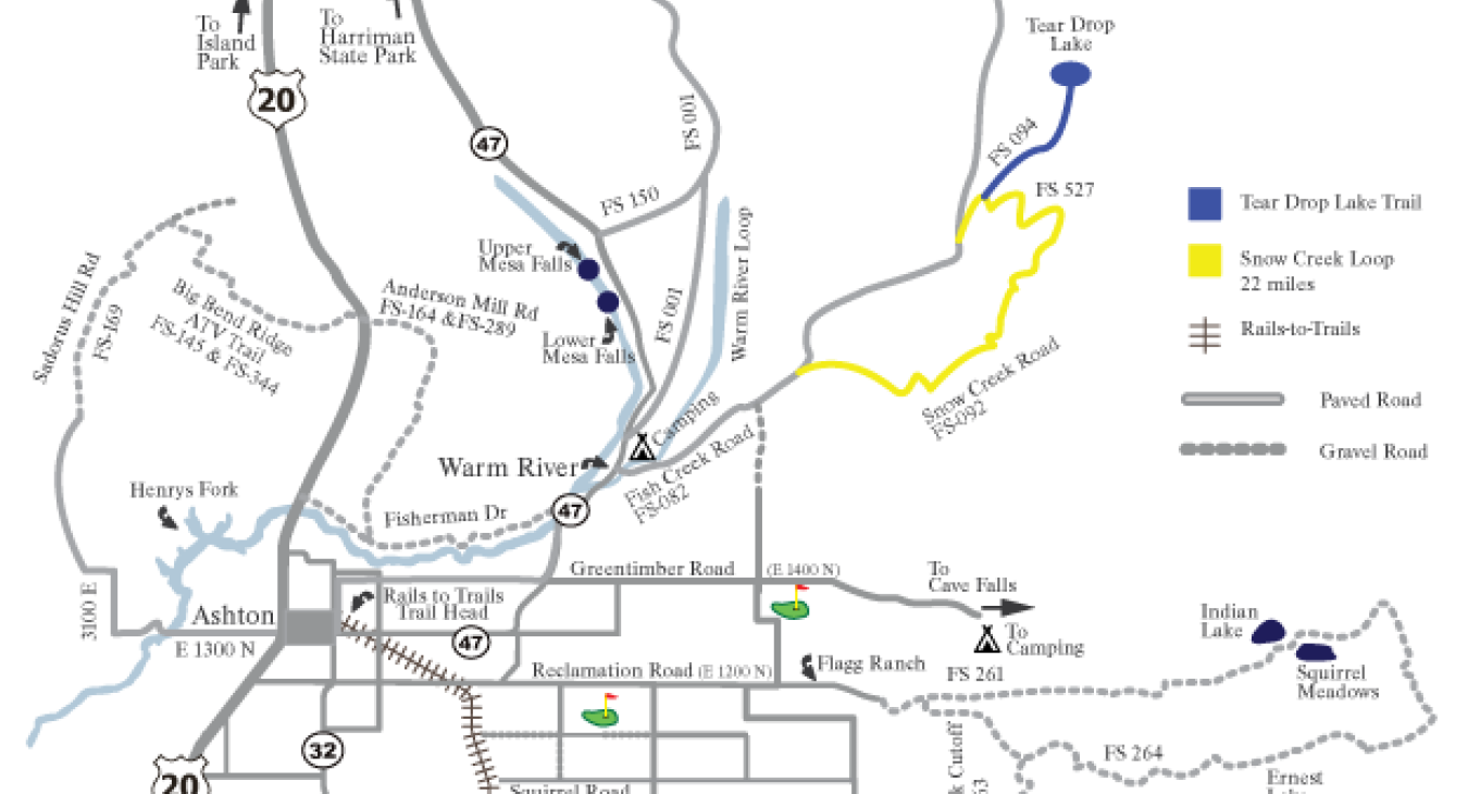
Snow Creek Loop - 22 miles
This loop begins at Warm River campground, follows Fish Creek Road (FS-082) for 9 miles, turns right onto FS-094, circles south at FS-527 to FS-092
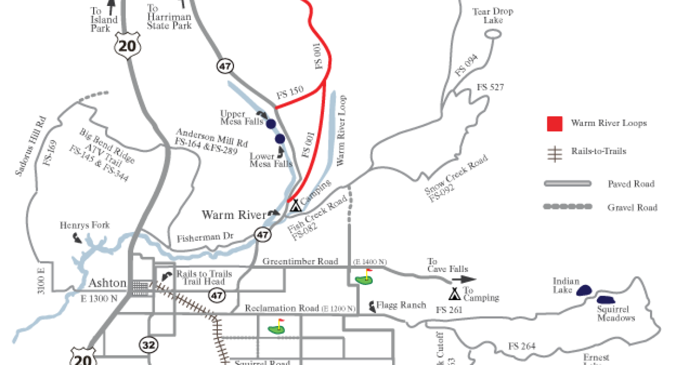
Warm River Loop - 30 miles
This loop follow the Railroad Grade Trail (gravel) north from the Warm River campground (FS 001), turns west on FS-315 to Hwy 47 to return to Warm
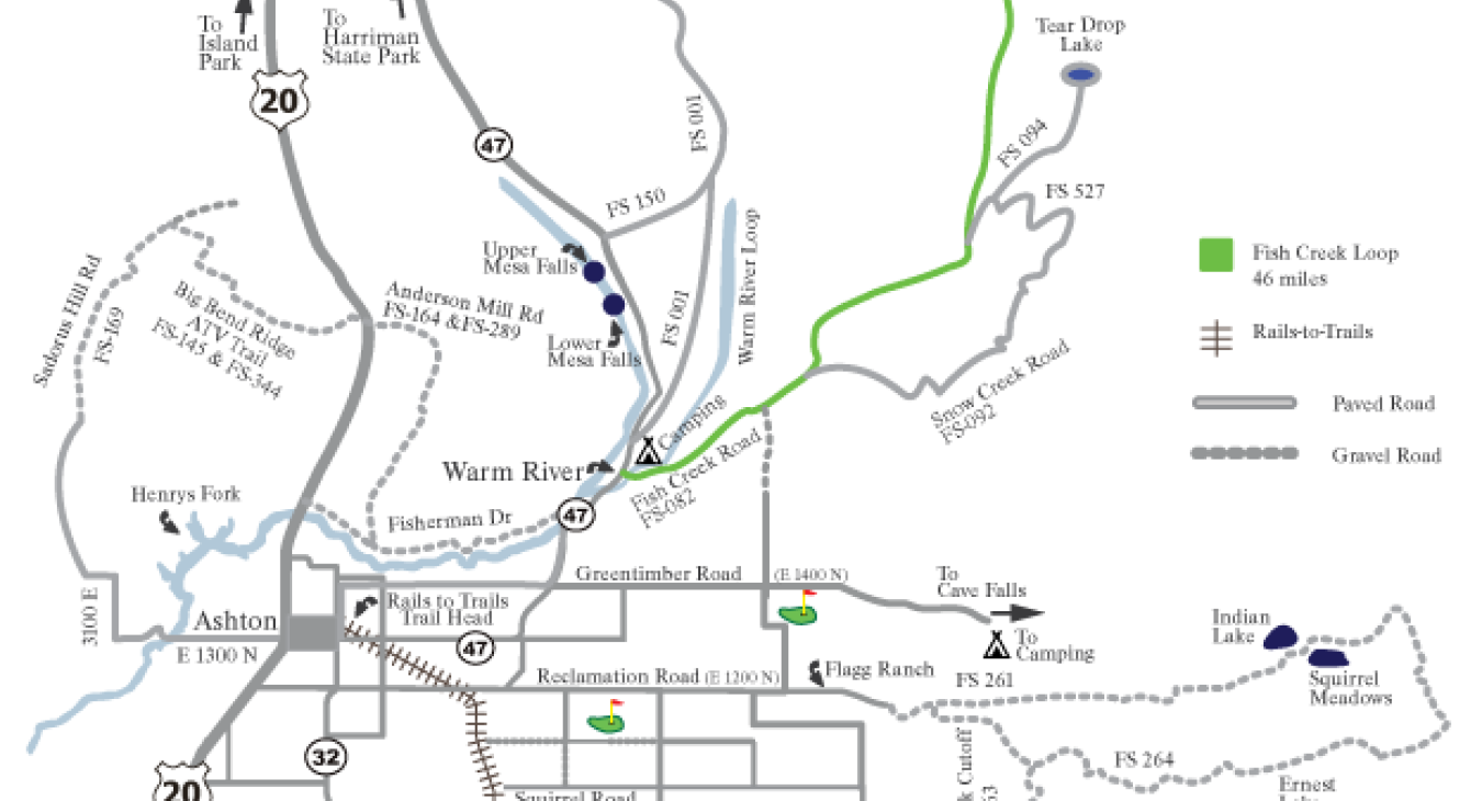
Fish Creek Loop - 50 miles
This loop begins at the Warm River campground, travels north-east on Fish Creek Road (FS-082) to Baker Draw Road (FS-161), turns south on the Railr

