Home
  • Home
  • Road Bike Routes
  • Mountain Bike Routes

Fremont County Bike Routes

trestle

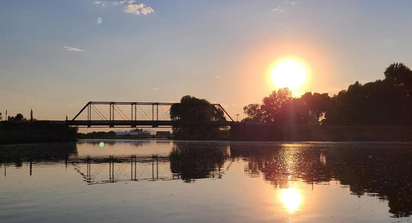
Set against the Yellowstone caldera and the foothills of the Teton mountain range, the area around Ashton provides a scenic and diverse setting for recreational bicycling. The area features rolling farmland with fields of barley and potatoes, a landscape bordered by national forests and the major rivers of the Yellowstone plateau, the Henrys Fork, Falls River, Warm River and Robinson Creek.

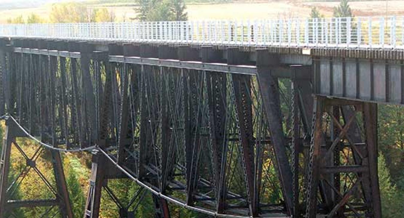
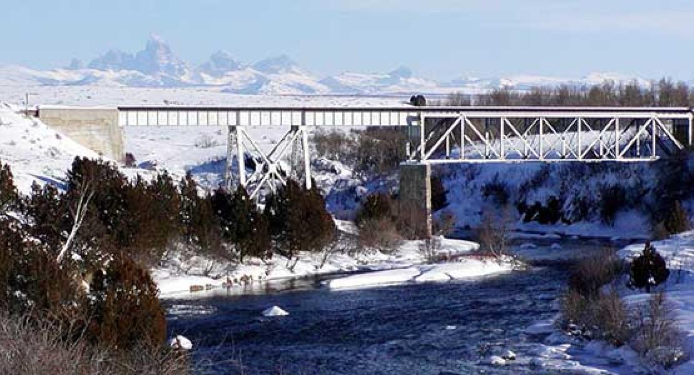
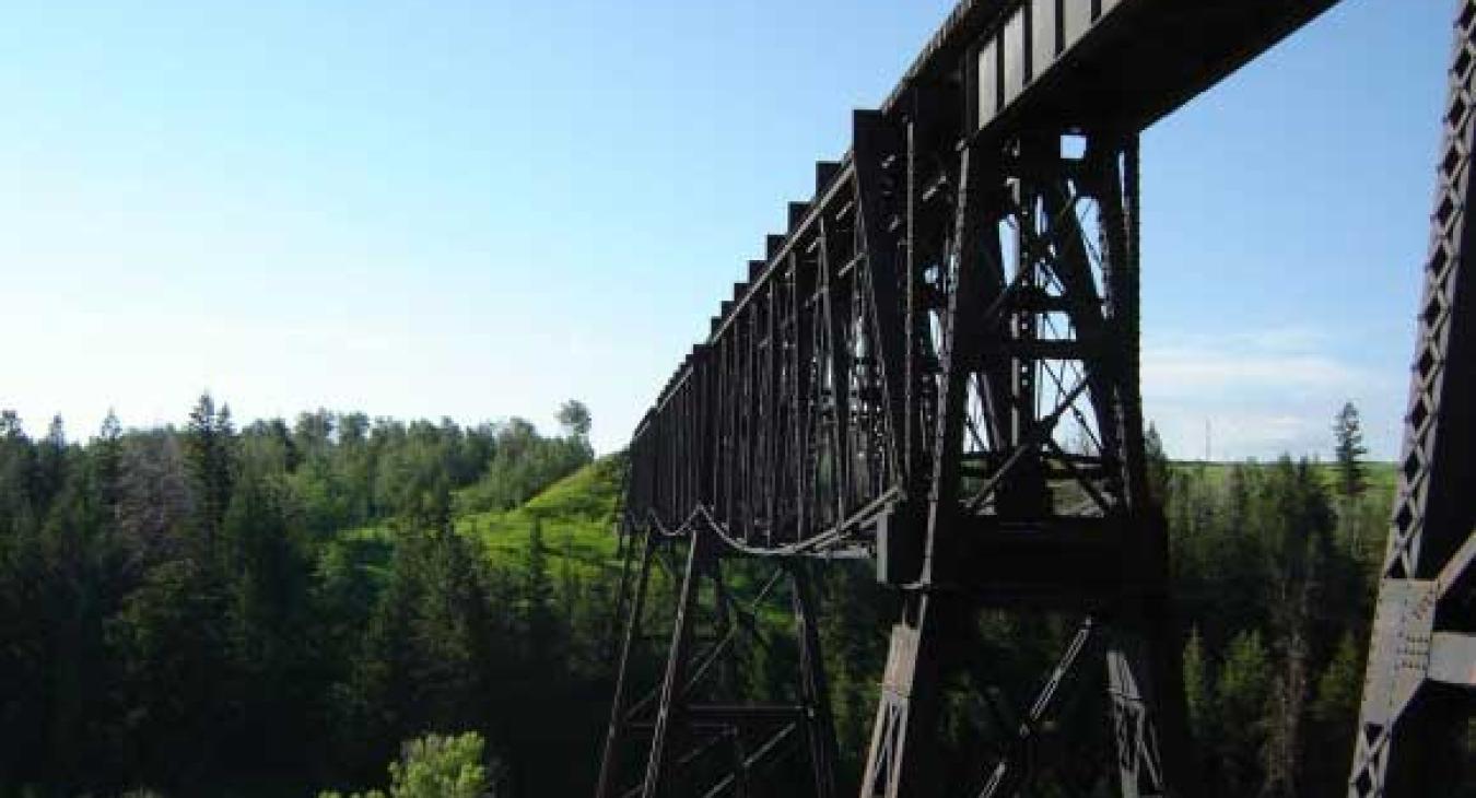
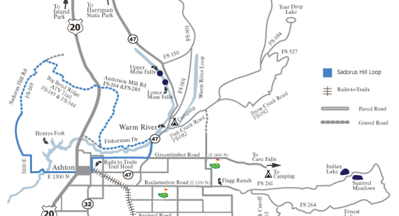
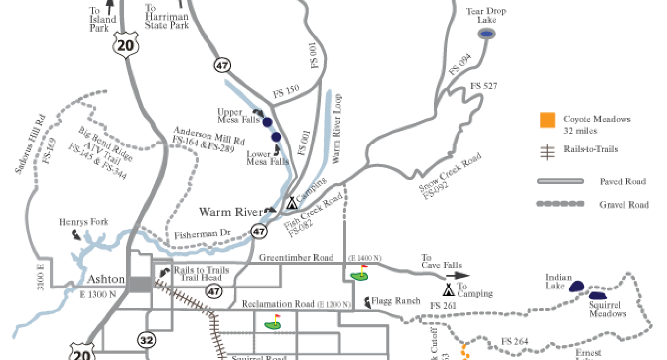
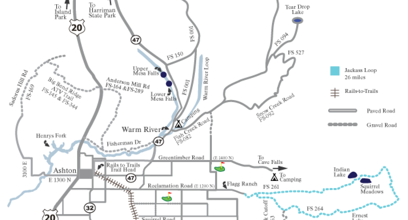
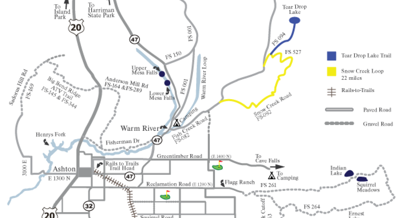
The bicycle routes indicated on this website are designed to take advantage of this inviting landscape. The centerpiece is the Ashton-Tetonia Trail, an abandoned rail line running east from Ashton into the Teton Basin. The rail line is now a state park devoted to bicycles and non-motorized public use, and it features three trestles crossing Falls River, Conant Creek and Bitch Creek.

trestle

The bike routes on this web-site center in Ashton, and follow lightly traveled paved and gravel county roads featuring moderate hills, river crossings and spectacular views. Some of the routes are entirely on paved roads, providing excellent opportunities for road bikes. A second set of routes follow US Forest Service roads and trails weaving across the rim of the Yellowstone caldera; these trails are multiple use and unpaved, giving mountain bikers a variety of challenging forested terrain.

  • Ashton - Tetonia Rails to Trails
    Ashton - Tetonia Rails to Trails
    Read more
  • Fun Farm Loop
    Fun Farm Loop
    Read more
  • Sandorus Hill Loop - 25 miles
    Sandorus Hill Loop - 25 miles

    This loop travels west from Ashton on the Henrys Fork Byway, crosses the Henry’s Fork at Ora Bridge, turns right (nor

    Read more
  • Coyote Meadows Route - 32 miles
    Coyote Meadows Route - 32 miles

    This gravel route begins on the Reclamation/Flagg Ranch Road, follows the Conant Creek cutoff (FS-263) south to the C

    Read more
  • Jackass Loop - 26 miles
    Jackass Loop - 26 miles

    This loop follows the Reclamation/Flagg Ranch Road east of Ashton, continues on a gravel road (FS 261) beyond Indian

    Read more
  • Snow Creek Loop - 22 miles
    Snow Creek Loop - 22 miles

    This loop begins at Warm River campground, follows Fish Creek Road (FS-082) for 9 miles, turns right onto FS-094, cir

    Read more
  • Warm River Loop - 30 miles
    Warm River Loop - 30 miles

    This loop follow the Railroad Grade Trail (gravel) north from the Warm River campground (FS 001), turns west on FS-31

    Read more
  • Fish Creek Loop - 50 miles
    Fish Creek Loop - 50 miles

    This loop begins at the Warm River campground, travels north-east on Fish Creek Road (FS-082) to Baker Draw Road (FS-

    Read more
  • Lamont Loop - 30 miles
    Lamont Loop - 30 miles

    This loop travels 10 miles east on Greentimber/Cave Falls Road (1400N), turns south for 3 miles on 4500E, crosses Fal

    Read more
  • Drummond Loop - 25 miles
    Drummond Loop - 25 miles

    This loop travels east 7 miles on the Reclamation/Flagg Ranch Road (1200N), turns south at the Squirrel Cemetery (430

    Read more

target link
Fremont County
target link
City of Ashton
target link
Ashton Chamber of Commerce
target link
Idaho State Parks & Recreation
target link
Yellowstone Teton Territory
Routes are primarily on paved roads. Be cautious and watch for vehicles.
Copyright © Fremont County Bike Routes, 2014-2025